Special Exhibition “The City – Exploring Yedo-Tokyo through Ancient Cartographs”
2024.03.06-2024.06.02
GREY CUBE
Yedo is an old transcription of Edo from the time when it was changing to Tokyo, the capital of the modern Japanese nation in 1868. Yedo-Tokyo, a megacity having experienced such a symbolic transformation, provides excellent material for studying the nature of the “city” from a historical perspective. While human beings originated more than seven million years ago, the emergence of the world’s first cities dates to just 6,000 years ago in ancient Mesopotamia. The city settlement system is thus a very recent development in human history. Because of this, or maybe because of our unconscious actions as residents, the dynamism of this latest settlement system, always changing like a living creature, is full of wonder.
This exhibition uses maps to explore the nature of the city of Yedo-Tokyo, which came into being more than 5,000 years after the birth of the world’s oldest cities. Maps should reflect society.
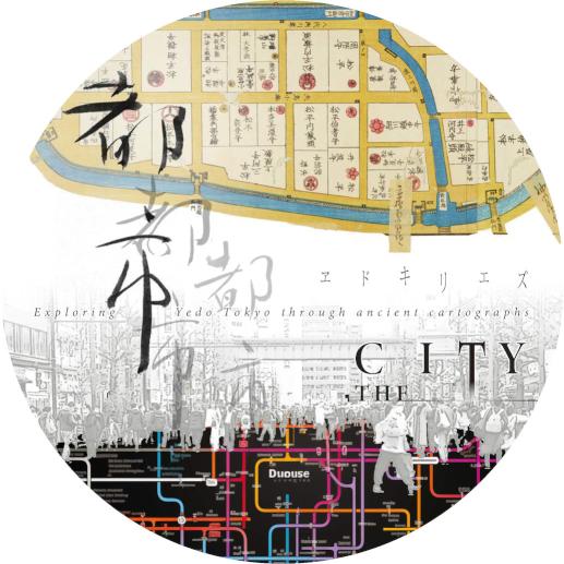
The main exhibit is Yedo-Kiriezu. They may look like contemporary regional maps based on latitude and longitude, but the land in Yedo-Kiriezu is divided according to arbitrary divisions determined by society at the time. The description system considering the location of Yedo Castle is no different from the ancient clay tablet map of Mesopotamia, which centered on Babylon. The inconsistency of scale in each map is also notable. This pre-modern design apparently persisted for a while, even after Yedo became Tokyo. Lafcadio Hearn (Koizumi Yakumo), a renowned Irish writer who came to Japan in 1890, recognized this particularity audibly. For him, the sounds of cities in Japan differed from those in England, which experienced the Industrial Revolution in the 18th century.
The Industrial Revolution eventually reached Tokyo in the Meiji era, re-grounding Japanese spatial concepts defined by the pre-modern power, and by extension, producing a new format for maps. Today, in the era of advanced digital technology, maps have become easily customizable by users. Furthermore, it is becoming possible for anybody to make maps, and with AI, a creator is no longer required. The understanding of cities based on maps has entered a wholly new phase. Nowadays, it is time to ask the fundamental question of how city maps are drawn, as they retain a different meaning from topographic maps of wilderness.
Starting with this exhibition, we will hold a series of exhibitions that look at cities from varied perspectives at different venues this year. We hope that our efforts will provide visitors with an opportunity to reflect on the present and future of the huge city of Tokyo.
Organizer: The University Museum, the University of Tokyo (UMUT)